Key Specifications
Angular Accuracy
Up to ±1 cm
Scan Speed
Up to ~1.92M pts/sec
Scan Range
Up to 300 m
Your browser is currently set to accept cookies. We use cookies to improve your online experience within Keypre.com. If you choose not to share your data, please go to your browser's privacy settings and turn off cookies. What do we do with your data? Click here to view our Privacy Policy. Thank you!

SKU: EXYNNEXYS
Up to ±1 cm
Up to ~1.92M pts/sec
Up to 300 m
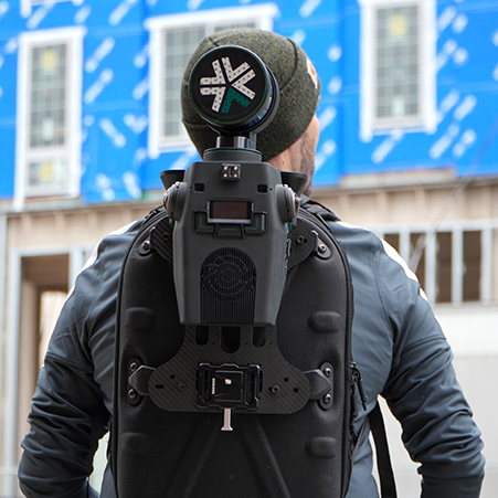
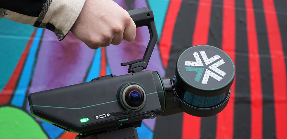
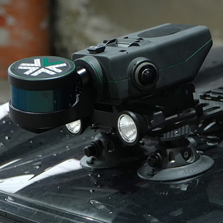
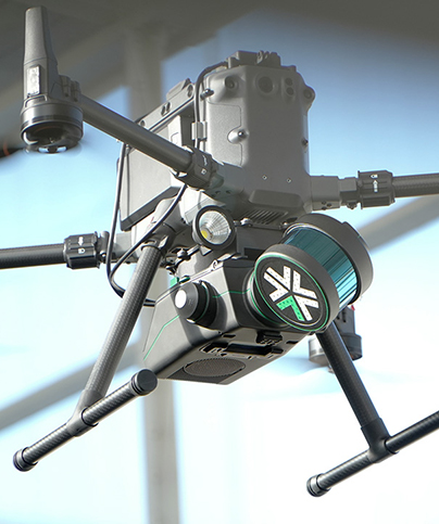
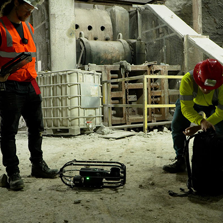
Nexys adapts to any platform you choose — handheld, backpack, vehicle, ground robot, or drone. It’s built for indoor spaces, underground tunnels, rugged outdoor terrain, and tight industrial environments.
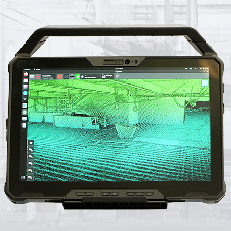
Capture, visualize, and process data on site with the rugged tablet and ExynView software. View real-time colorized point clouds and export formats like LAS, XYZ, and RGB for seamless CAD or BIM integration.
For hazardous or hard-to-reach locations, Nexys can be upgraded with ExynAI for fully autonomous aerial or ground mapping. No GPS, no pilot, and no prior map required. Ideal for mines, tunnels, industrial facilities, and disaster-response environments.
A fully modular mapping ecosystem to quickly capture accurate, colorized, real-time 3D point clouds in a variety of physical configurations, levels of autonomy, and environmental conditions.