Keystone Precision Solutions (KPS) is your total solutions company for Mobile Mapping Systems.
Mobile Mapping Systems are vehicle-mounted mobile spatial imaging systems that integrate geo-referencing technologies with very precise, high-speed laser scanning and high-resolution imaging sensors which can quickly collect large quantities of highly accurate data which can be transformed into very detailed 3D models. The applications for Mobile Mapping include fast and efficient surveying of a large corridor or project and to generate deliverables such as road and rail assets, telecommunication asset inventories, highway assets, utility assets, road surface information, and more.
KEYSTONE PRECISION SOLUTIONS IS THE TOTAL SOLUTION FOR ALL OF YOUR MOBILE MAPPING NEEDS.
Beyond equipment, Keystone Precision Solutions provides in-house repairs and preventative service, rental and loaner equipment, training and technical support for both the hardware and software, and we also consult with you to help your business thrive.
Our protection plans far exceed the factory warranty for circumstances such as accidental damage, wear and tear protection, and preventative maintenance.
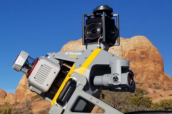
Trimble MX9 Mobile Mapping System
Roof mounted field to finish mobile mapping solution that combines advanced hardware with intuitive field software.Quickly captures both panoramic and multi-angle laser scans as you drive at highway speeds which avoids the need for road closures and having employees working on busy highways.Used by transportation professionals, highway or rail inspectors, civil engineers, and city planners.
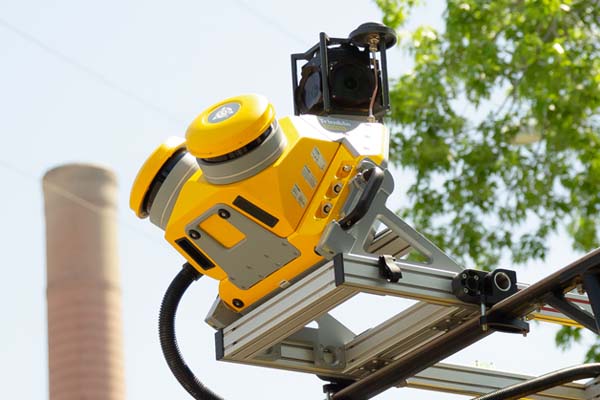
Trimble MX50 Mobile Mapping System
Roof mounted mobile scanning and imaging for asset management and road maintenance.Features accurate point cloud to provide extraction of asset location, size, condition, and other inspection information.A practical mobile mapping system that combines precise LiDAR data and immersive panoramic imagery.